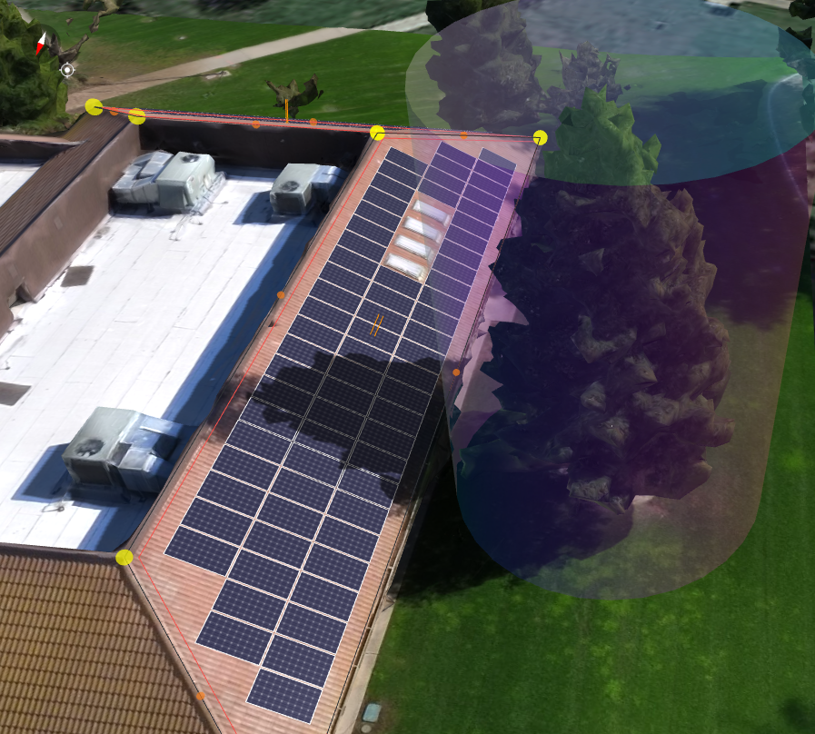
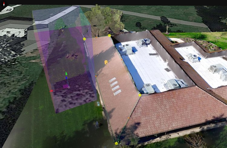
Scanifly’s Occluder Tool hides objects and prevents them from casting shadows in 3D environments.
Trees regularly shadow houses and reduce solar array effectiveness. In response, many homeowners are happy to remove them—but first, they want to know what impact tree removal will have on solar production.
In the past, scoping for tree removal has typically meant looking with remote imagery or hand measurements—but trees and overall site context are not easily assessed or reliably captured with these methods. If you conduct on-site surveys with a drone, on the other hand, you’ll easily capture all this important info in a single visit every time.
1. Measure trees with a drone
When conducting an on-site survey, use a drone to capture tree information in addition to the roof measurements. In particular, you’re looking for:
-
Tree dimensions: mainly the diameter of the tree and sometimes height (you can also do this with Scanifly’s ruler tool).
-
The current state of trees: use the drone images album to review photos and assess the trees.
PS—don’t know how to fly a drone? It takes about a week to get FAA licensed or you can simply outsource drone work.
2. Capture site context
Using point of interest (POI) or grid pattern flying, capture the entire site context. In particular:
-
Access points: for example, the distance between the fence and the house. This will help determine if the machinery to remove trees will fit properly.
-
Elevation: this is particularly relevant for jobs with drastic differences, but you can use an elevation heat map to assess flatter properties as well.
-
Water conservation location: to safely remove trees you will need to be 100 feet away (or more) from pooling water.
All of this information can be captured with the drone and measured within Scanifly’s platform, making the process simple.
3. Build a plan foundation in Scanifly
A plan foundation needs to communicate two things: which trees to remove (plus any obstructions to be aware of) and the impact of removing trees on shadowing, shading, and solar production.
Within Scanifly, you can mark all trees and obstructions using the annotation feature. After that, you can use Scanifly’s occluder tool and bankable shade analysis to calculate the estimated solar production impact of removing a tree (or planting a new one).
4. Make a removal plan
Screenshot showing the Cube Occluder tool being used to occlude (hide) a tree near a roof that would have cast a shadow on the roof.
Once you know which trees are being removed and where to avoid, you can make the final plan—the pathways for machinery to know their access points and roadways. Within Scanifly, you can mark these using keep-out zones. From there, export your plan and share it as needed—you can share the plan itself or the entire visual site context so everyone can see the property in 3D.
Tree removal can be expensive and time-consuming, whether for solar or any other use case. Drone technology did a lot for aerial images, giving people a bird’s eye view of the property with significantly higher quality than satellite imagery. Add Scanifly’s powerful design tools and you get an easy-to-use platform that makes tree removal in property designs efficient, simple to outsource if needed, and perfectly accurate.