The only residential and commercial solar design software built for sales and operations. Design instantly with AI, and verify with drones, all on one platform.
Companies That Trust Scanifly
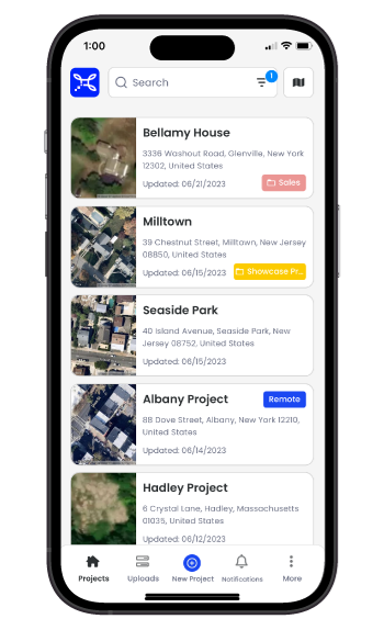
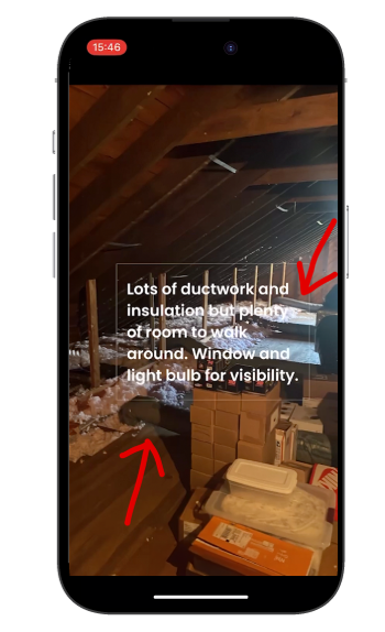
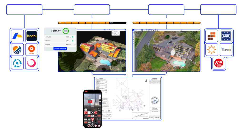
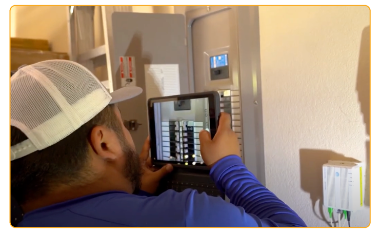
Field Data Collection & Digital Checklists
Scanifly’s mobile app is like SiteCapture and CompanyCam—but purpose-built for solar field ops—and free with any design product subscription.
Solar Design Services for every stage of your project
Let our experts do the work for you, all from within your Scanifly account.
Wireframes
Receive your 3D model with roof planes and obstructions outlined, ready for panel placement and production.
Under 1 Hour Turnaround Time
Roof Outlines
Obstruction Detection
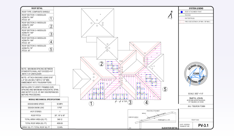
Plan Sets
Generate customizable AHJ-approved plan sets and stamps in under 48 hours using perfectly accurate 3D models.
Under 48 Hour Turnaround Time
Full Plan Sets
Engineering Stamps
Consolidate Your Solar Tech Stack
Scanifly integrates with your favorite proposal tool, CRM, or customer portal and your preferred racking and finance partners.
Meet The Modern Solar Survey And Design Workflow
Accurate field data and solar designs go hand-in-hand, which is why we centralized them on our platform.
Step 1
Gather Perfect Measurements with a 5-minute Drone Flight
Fly a drone to capture exact roof measurements and real-time shade data—eliminating time-consuming roof climbs without compromising accuracy.
Scanifly’s design software is compatible with any drone that has GPS and a camera
Reduce your onsite time by up to 90%
Step 2
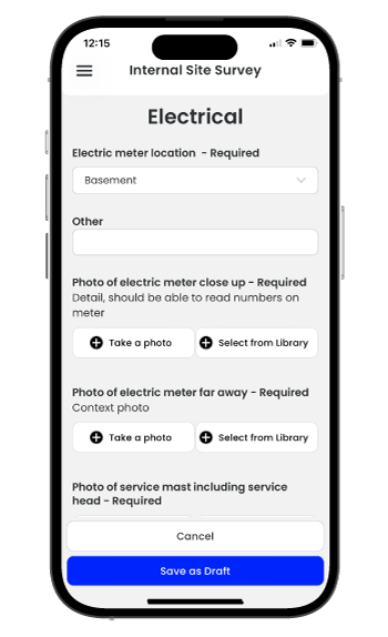
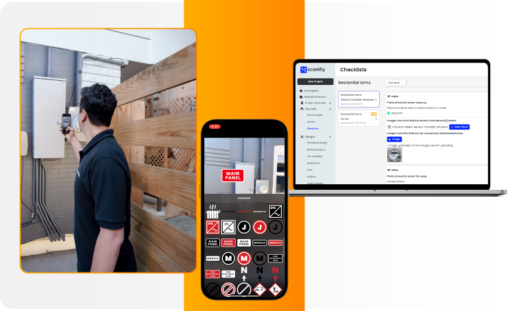
Simplify Data Collection with Customizable Checklists
Ditch the pen and paper! Easily capture all structural, electrical, and property information with digital checklists.
10+ pre-built industry-standard checklist templates for any operations and financing workflow
Centralize site survey and design data on one platform—improving collaboration between your field and office teams
Step 3
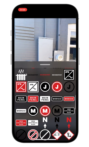
Upload Site Data From the Field
Submit completed checklists and drone images directly from the app, giving your designers everything they need while you head to the next site visit.
Track the progress of field work from the office
Surveyors save up to 2 hours per day by uploading data on the fly
Step 4
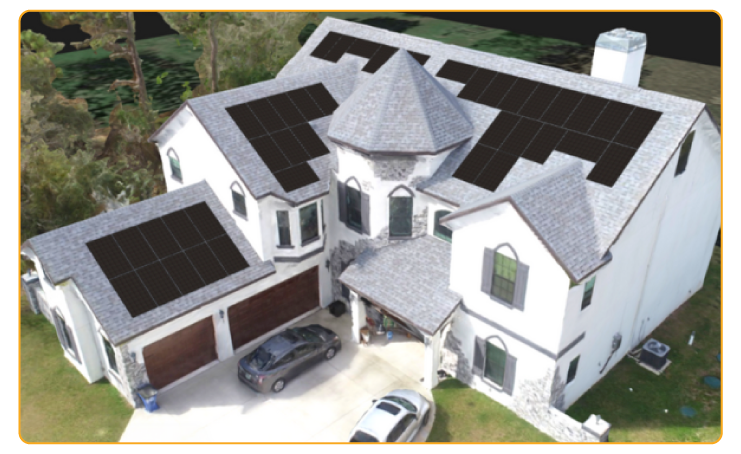
Transform Drone Imagery Into Photorealistic 3D Models
Scanifly’s software uses proprietary photogrammetry and AI to automatically produce a to-scale 3D model, providing the perfect canvas for designing PV systems and plan sets that always fit on install day.
Designers never have to worry about rework or revisions
Eliminate TPO financing rejections with real-time onsite shading analysis
FAQS
SURVEY
Who flies the drone?
Your surveyors or sales reps will fly the drone during the site visit. Think of the drone as another tool in your toolkit. Instead of needing a ladder or tape measure to get on the roof, you just need a drone. Minimize or eliminate your roof climbs or manual measurements.
What drones work with Scanifly?
Any drone that takes geo-tagged images pairs with the Scanifly software. Scanifly’s team of solar and drone experts provides free assistance with drone procurement, management, and flying instructions.
Does Scanifly sell drones?
Nope! Scanifly is not a drone company. We provide the design and field operations software that pairs with any drone with GPS and a camera. This gives you the flexibility to purchase whichever drone fits your specific needs and budget.
What if I don't have a drone?
If you’re not planning to purchase a drone, Scanifly can outsource the drone survey for you for an additional fee. Contact Scanifly’s support team to schedule the survey and you’ll receive all drone images, survey photos, and the drone-based 3D model within 3-5 business days.
DESIGN
How accurate is DroneDesign™ — Scanifly’s drone-based design software?
Quantitatively, Scanifly uses the most up-to-date site and shade data available and is accurate to within 1-3 inches of hand measurements. Anecdotally, what you design in Scanifly will always fit on install day.
How accurate is PrelimDesign™ — Scanifly’s front-end remote design tool?
Scanifly’s PrelimDesign™ offers remote design capabilities similar to all other PV design software — including Google Maps and other satellite imagery providers, LiDAR-based shading, and Nearmap. Additionally, PrelimDesign™ has the same flexibility and customization as other design software — including a sales design experience called, Simple Design. PrelimDesign™ is significantly more affordable than some design tools, and the only solution to integrate with your post-sale field and final design and engineering workflows, providing one centralized design environment for every stage of your project.
What is the difference between Scanifly’s PrelimDesign™ and DroneDesign™ tools?
Scanifly PrelimDesign™ includes satellite imagery, Nearmap, and LiDAR, and it is used primarily for sales quotes and initial economic conversations with homeowners. Scanifly DroneDesign™ (onsite) provides better accuracy and real-time shading. It is commonly used post-sale to true-up your PrelimDesign™ (remote)—ensuring everything will fit perfectly on install day and that you’re not overpromising (or underselling) on system production.
Who has approved Scanifly’s shading analysis?
Scanifly’s proprietary shading analysis—its Viewshed technology—offers the same accuracy as other onsite real-time shading tools like the Solmetric Suneye and Solar Pathfinder. It is more accurate than remote shading used in preliminary design software. It has been approved by all major regulators and lenders: NYSERDA, MassCEC, CEC, Austin Energy, Commerce RI, Energy Trust of Oregan, LightReach, EverBrite, Sunlight, and others!