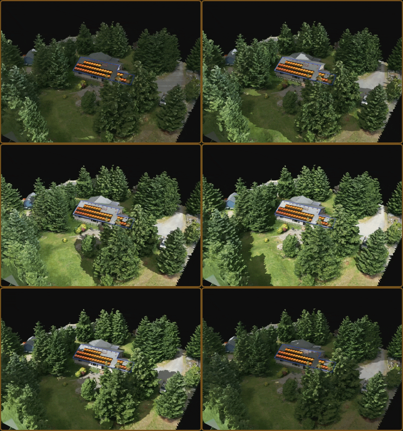
Shading That Simulates Real-Time kWh
On-site shading is 30% more accurate than remote + LiDAR. Scanifly shading
is approved by regulators and lenders with TOF, TSRF, and ASA values.
Who Does Shading Impact?
Contractors
Production guarantees or not, contractors stand behind their sales estimates. Reputations, and in some cases liabilities, are at stake if production falls short.
Project Owners
System owners require accurate production estimates in order to analyze utility bill offsets, payback periods, and the ROI of going solar.
Regulators
Governments and other local bodies offer incentives, contingent on project feasibility and production thresholds.
Never Overpromise & Underdeliver
Scanifly’s solar shading simulation is how surveyors and designers get current on-site data without going on the roof. By capturing drone-level imagery and measurements, Scanifly3D generates proprietary solar access viewsheds as accurate as the SunEye and Pathfinder tools and more reliable than LiDAR.
Real-Time, On-Site
Shading Data
Generate TOF, TSRF
& ASA Values
Easily Plant &
Remove Vegetation
Approved by Major
Regulators & Lenders
No More Dangerous Roof Climbs
With Scanifly and drones, surveyors capture on-site shading data without using a SunEye or Pathfinder on the roof. Save time and keep your team safe.
Simulate Shadows For All Seasons
Use Scanifly3D to visualize shadows of trees, obstructions and anything on-site at any time of the day or year. Utilizing local weather data and tracking the sun's path, Scanifly determines TOF, Solar Access, and TSRF values for each panel and array.
Capture On-Site Shade Data, From Your Desk
Scanifly3D’s virtual solar viewshed calculations are within 1% of SunEye readings at the same site and can be 30% more accurate than shade reports derived from satellite imagery and LiDAR.
Remove Trees and Obstructions with Ease
Utilize Scanifly’s Occluder Tool to easily adjust trees and other structures in your 3D environment, while calculating its impact on PV system performance. The Occluder Tool masks objects with just a few clicks, preventing them from creating shadows in the scene.
“Using a Solmetric becomes very cumbersome to take say 20 shots, where with Scanifly, you can simply plot a sun chart from anywhere in a matter of seconds.”
-Mike Hewitt, VP & Operations Manager at E2 Solar
Explore More Resources
Why Scanifly is the New SunEye
Discover the advantages of safer surveys, identical regulatory approvals, faster designs, and more affordable technology for on-site shading.
A Brief History of Solar Shading Tools: From Handheld Hardware to Flying Drones
We’ve witnessed the evolution of shading analysis tools firsthand and identified three phases of shading tech, each more precise, scalable, and cost-effective than the last.
3 Reasons Why Onsite Shading Data is Better than Remote Shading Data
Learn the reasons why satellite imagery doesn’t hold up for final layouts - and why on-site data solves this problem.