Almost all solar projects begin with a preliminary design and shading analysis typically based on satellite and other remote imagery. The resolution, timeliness and quality of this imagery is insufficient to finalize a layout, which causes 92% of solar contractors to visit a project site before installation to verify data. The impact of satellite imagery on the precision of solar shading is even starker.
To further explain this scanifly.compared satellite imagery and onsite data for 18 roof planes across varying topographies and house structures in multiple U.S. states. We found that 30% of sites had a 10%+ discrepancy between satellite data and onsite data. If a contractor just used satellite imagery this would seriously impact production, performance and the financial viability of the project.
Here are three reasons why satellite imagery didn’t hold up – and why onsite data solves those problems.

1. Remote imagery misses site context; onsite shading data captures it all
Satellite imagery is captured at a top-down, “nadir” angle, and is often grainy. This makes it informative for identifying the location of large objects (e.g. trees, HVAC units, etc.), but challenging to determine small objects or the heights of all objects. A common practice is for designers to estimate the height of trees and use that in designs and shade studies. Salespeople may manipulate tree heights arbitrarily to show a larger production offset in order to increase their likelihood of closing the sale. In either case, the tree height is usually not perfectly accurate.
Satellite imagery also had a harder time capturing the entire site context of a property, including poles, roof vents, other buildings casting shadows nearby, and additional information that might impact where panels can go and where shade might be. Satellite imagery’s 3D capabilities are also highly limited.
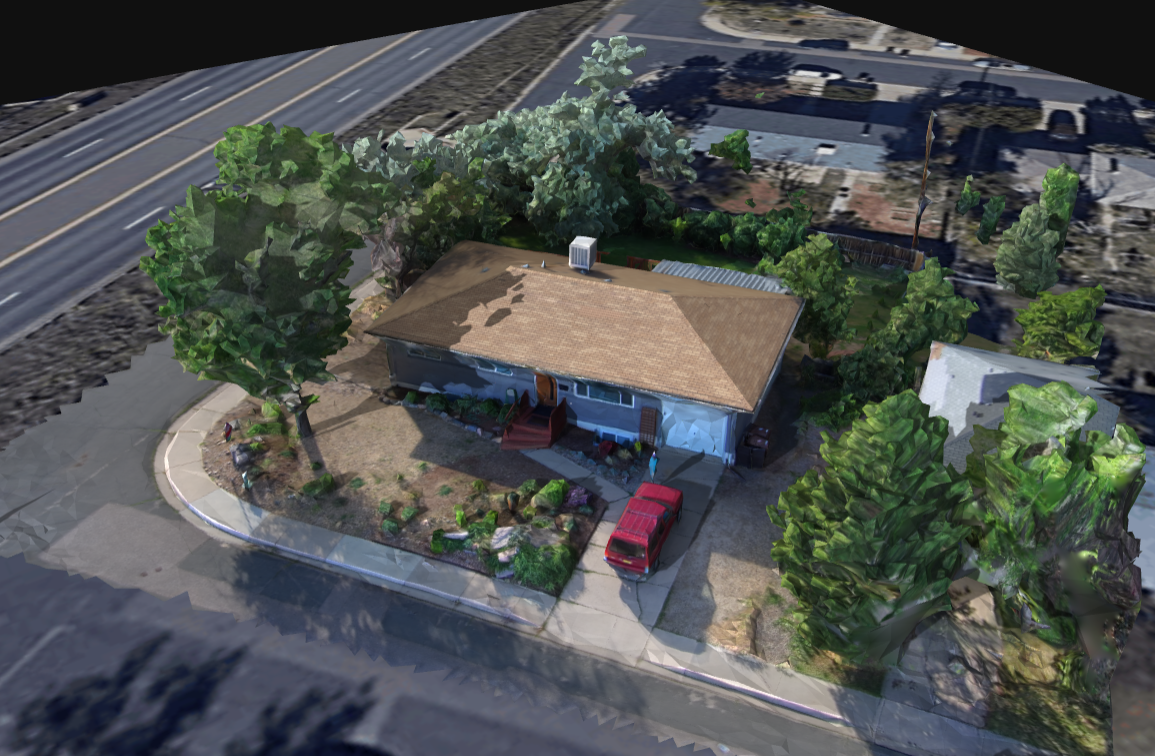
When flying a drone, especially in a point of interest (POI) flight pattern, thus capturing oblique imagery, you capture nearly all of the site context, in 3D, and in real time. This allows you to quantify the full dimensionality of properties, and their shading implications.
2. Remote imagery is dated; onsite shading data is always fresh
Even when satellite imagery is clear, you might be looking at an outdated image. Satellite imagery might miss details such as a tree growing or being cut down, or an electrical pole being placed on or near the property edge. At worst, satellite imagery of new construction will just show undeveloped land, rendering it unusable.
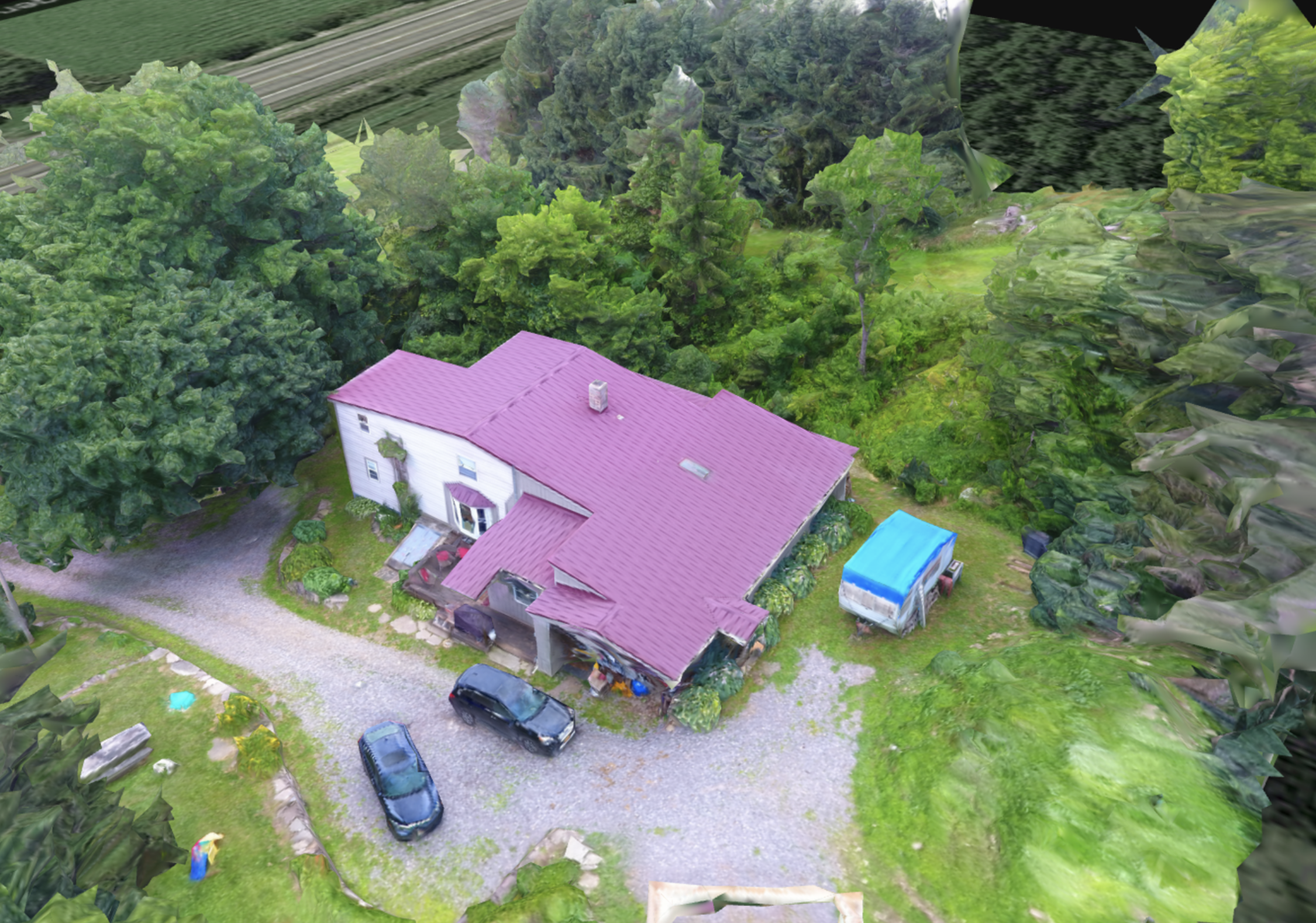
Capstone Solar
These details may not seem like much but can impact shading analysis dramatically, and are the main explanation for the study’s results. It also leads to missed customer expectations. If you offer production guarantees, these details will end up mattering a lot.
Some solar contractors will use airplane imagery to fill in, but even that is still outdated, and coverage is limited in many parts of the United States. This is particularly true in more densely populated areas where airplane data might only be updated 1-2x per year, if that.
With drones onsite, you know you’re capturing the most recent images you possibly can. Further, being onsite gives you the opportunity to speak with homeowners who can inform you of any major planned changes, which can then be taken into account during the design phase. Software like Scanifly can help with future changes, since the 3D model produced by Scanifly has a feature where you can place additional trees in the model to see how it would impact shading analysis. You can also remove tree vegetation in the model to simulate onsite activity if a homeowner says a certain tree is being cut down or trimmed. Scanifly’s drone software is also the only drone-based tool to be approved by all the major solar regulators and lenders.
3. Remote image perspectives leave room for error; onsite shading data captures reality
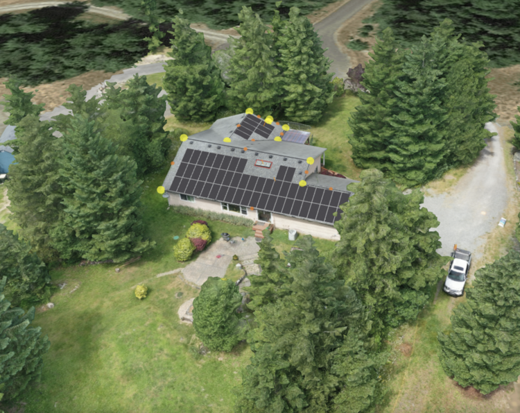
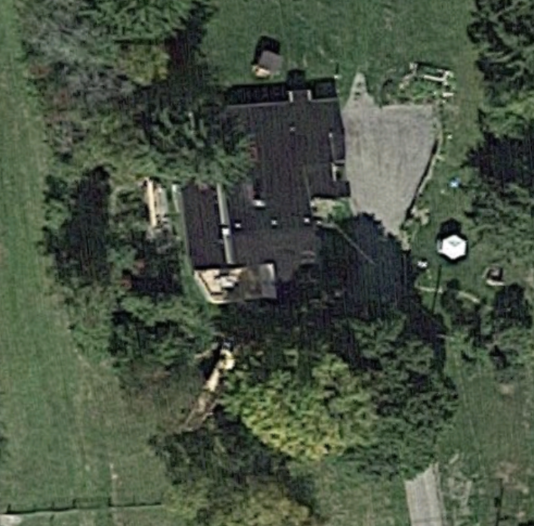
Two dimensional satellite images are taken from a mile or two away, leaving grainy and slanted images if it’s not orthorectified correctly, which results in a lot of guesswork for solar designers. For example, if you can see the facade of a structure (see image 1 below), the satellite image will lead to skewed designs and compromised layout measurements. In the end, designers will have to rely on their best guess.
Two dimensional satellite imagery also doesn’t provide the elevation data needed to generate an accurate shade analysis. Solar design tools need to take the topography into account (see image #2 below), which is something satellite imagery can’t provide at a granular level. The image below is a section view of a property where B, the drone data created 3D model, is showing a change in elevation. Capturing reality allows us to see that the tree to the south is at a lower elevation than the building to the north. The 2D satellite image labeled as A, is showing no change in elevation, thus simulating PV production and shading in a scenario where the world is flat.
If a solar contractor operates from skewed 2D design data, the resulting installation may yield lower production than promised. This can be a problem not just in terms of production guarantees, but also in poorly met customer expectations that can lead to customers talking negatively about a contractor and not sending any referral business.
1. A satellite image that is not 100% orthorectified. Note the western facade is visible.
2. A section view showing A) 2D satellite imagery tile and B) a drone data created 3D model showing a change in elevation.

Using drones onsite ensures high quality images that automatically make a model and can facilitate streamlining creating CAD files. This gives designers a comprehensive view of the site that removes the possibility of human error.
Remote satellite images can be helpful, but don’t rely on them for designs
Relying exclusively on satellite imagery for shading analysis, where 30% of sites can be significantly different than what is really onsite, can be very detrimental. So, while satellite images are helpful for high-level site context, notably for preliminary designs and proposals, or to generally explain site features to a surveyor or customer, they are not good enough for final designs. Furthermore, if a contractor is going onsite to collect internal data for the property, why not leverage drone data as well? The earlier in the process a contractor can collect information on the project, the better it is for customer expectations, cost estimates, and project planning.
When it comes to actually building out designs, leverage onsite data from a drone. The cost of the truck roll might seem costly up front, but you save significant time and money down the line in the form of accurate production designs, saving insurance costs (since drone surveyors don’t need to go on the roof), and delivering on promises to customers without delay or refactoring.