Most drone pilots are familiar with pre-planned grid pattern flight paths made popular by flight apps like DroneDeploy and Pix4D. They are fully automated (i.e. “touch a button and go”), simple to set, and quick, and as a result increasingly ubiquitous in drone applications across industries. However, conducting a pre-construction site survey for residential rooftop solar projects is different.
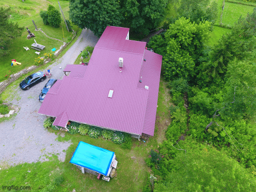
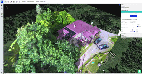
Contrary to belief, rooftop solar should instead incorporate orbit shaped flight paths or “point of interest” (POIs) settings. When surveying residential solar projects, specifically, capturing imagery from an oblique angle is key. Most grid patterns have nadir camera angles, which entails flying with the camera facing down. This top-down view misses a lot of key data. Oblique angles from orbit patterns are the best way to capture valuable z-axis or vertical data, such as facades, the sides of vent pipes or chimneys and vegetation.
Here are four solar-specific reasons why orbit patterns are better when flying drones for residential solar site surveying:
1. Obstruction detection
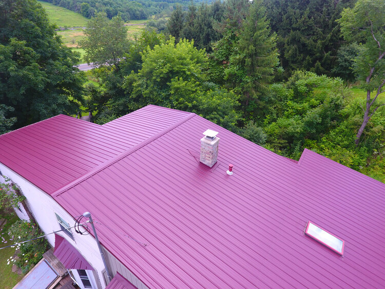
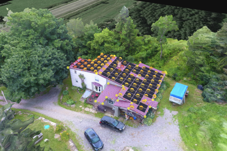
Roofs (even flat roofs) have many vertical features on the z-axis, such as chimneys, vent pipes, attic fans, or roofs with different elevations. These “obstructions” are critical to photograph because they are areas where solar modules cannot be placed, and thus drive the accuracy of a solar project’s layout and total amount of energy produced onsite. What makes things even more difficult is that some obstructions are painted the same color as the roof to blend in.
Because a nadir angle has the camera pointing straight down, the actual heights of these obstructions can appear skewed, or worse, enmeshed in the roof itself. Poor data capture of obstructions can lead to a poor PV design. Oblique imagery with an angled camera picks up the heights and details of obstructions, which enhances the quality of a rendered 3D model and thus a finished design set.
2. Vegetation recognition
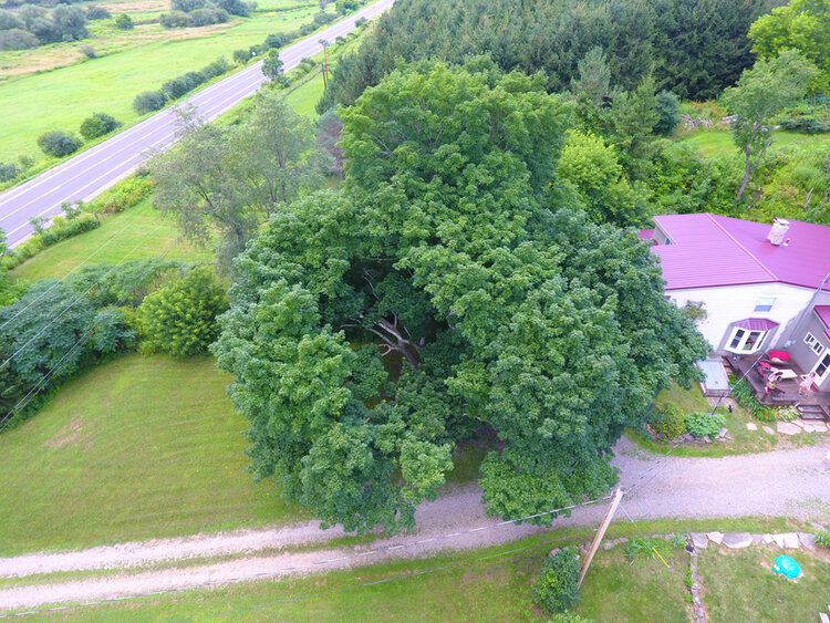
Like obstruction detection, a grid pattern will not pick up all the verticality of a tree (or any other vegetation) as well as an orbit flight pattern, and thus not properly capture its size for shading purposes. Flying around trees using orbits is important because it too will allow for better analysis of how much solar energy can be produced on a site. Without an accurate onsite shading analysis, the solar project’s production forecast can be compromised.
Poor vegetation recognition also affects customer costs and expectations: customers purchase solar systems expecting specific production forecasts (i.e. in some cases “production guarantees”), but are then disappointed when those systems have poor performance due to inaccurately measured shading. Alternatively, customers may also question why open roof space was not used for solar if shading is over-estimated and therefore modules aren’t placed in a certain location. That is a missed opportunity for a larger solar array. Both cases can end in a bad reputation for solar contractors. However, both are avoidable. Drones flying using orbit flight paths will easily photograph the full profile of any vegetation on site, making designs and solar models easier to render.
Source: Scanifly software
3. Visual appeal
Simply put, outputs from orbit patterns just look better. It captures images from multiple angles and creates a 3D model which can be used for marketing imagery and better customer experiences. Nadir imagery, on the other hand, often captures roof details from above but little else, making it feel more like a 2D flat roof blueprint than an engaging 3D model. Or worse, nadir images can make facades look like they are melting, which occurs from poor data. The best way to capture a real world context or a “virtual environment” is with images from all sides using oblique imagery.
4. Know your technology
We fully understand the ease and value of a pre-planned, fully automated flight path. However, with residential rooftop solar there are more onsite nuances to consider. First, we recommend careful planning prior to flying, including using checklists and understanding airspace. This also entails checking your hardware and understanding how to use it. Flying pre-planned missions can sometimes give pilots false confidence and lead to reduced preparation. Once onsite, analyze the property conditions and tweak your plans accordingly. For example, if there is more tree coverage than expected, expand your orbit’s radius or change the altitude. If the house has more rooftop obstructions than satellite imagery showed, then multiple orbits could be beneficial. Finally, while grid patterns have full site coverage, orbit shapes are typically flown with higher image overlap and are easier to audit for any post processing.
Garbage in, Garbage Out
For residential rooftop solar, having high quality images from an orbit flight path leads to a complete 3D model and is important for an accurate design. Grid patterns with nadir imagery gained popularity due to multiple free apps and from mapping large swaths of topography or stockpile sites. However, orbit patterns with oblique imagery capture settings are now fairly easy to access, with many drones capable of flying in point of interest mode or orbit patterns like DJI’s Mavic Pro, DJI’s Phantom Series.
Ultimately, data capture is in the hands of the pilot. A model created from oblique imagery might be slightly more work for the pilot, but your outputs will allow you to maximize both the accuracy and marketability of project designs, and you likely won’t need to manually verify any measurements onsite.