Blueprints, plan sets, layouts, and as-built diagrams are almost always in 2D. It’s been this way in most contracting industries, including solar, for decades.
But that doesn’t mean it’s ideal.
Visualizing a project in 3D has notable benefits for solar projects, but historically it hasn’t been feasible to create automatic 3D representations of the site.
The advent of cloud computing, along with advancements in computer vision, propelled a century-old concept called photogrammetry – the ability to create 3D models from geotagged images – to the forefront of design, making it easier than ever to create designs that more accurately mirror reality.
1. More flexibility to survey any roof
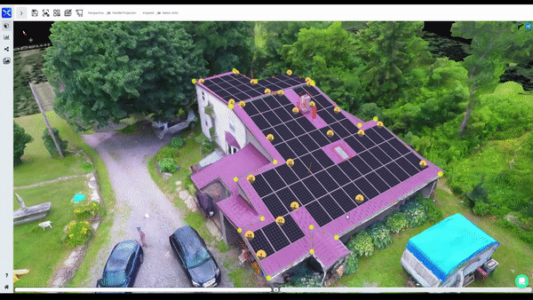
In the solar industry, the roof is your canvas. However, there are many types of roofs.
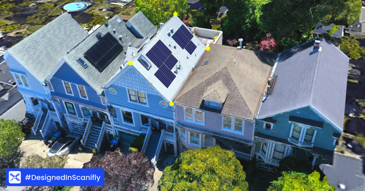
Houses in Texas have 45-degree pitches across 8-10 roof planes, with many being new construction. In places like Arizona and New Mexico, residential properties tend to be flat roofs, while southern California has a lot of delicate Spanish tile, which easily cracks under a surveyor’s boot. In contrast, homes in the Northeast are often older with notable diversity of shape, size, and dimension.
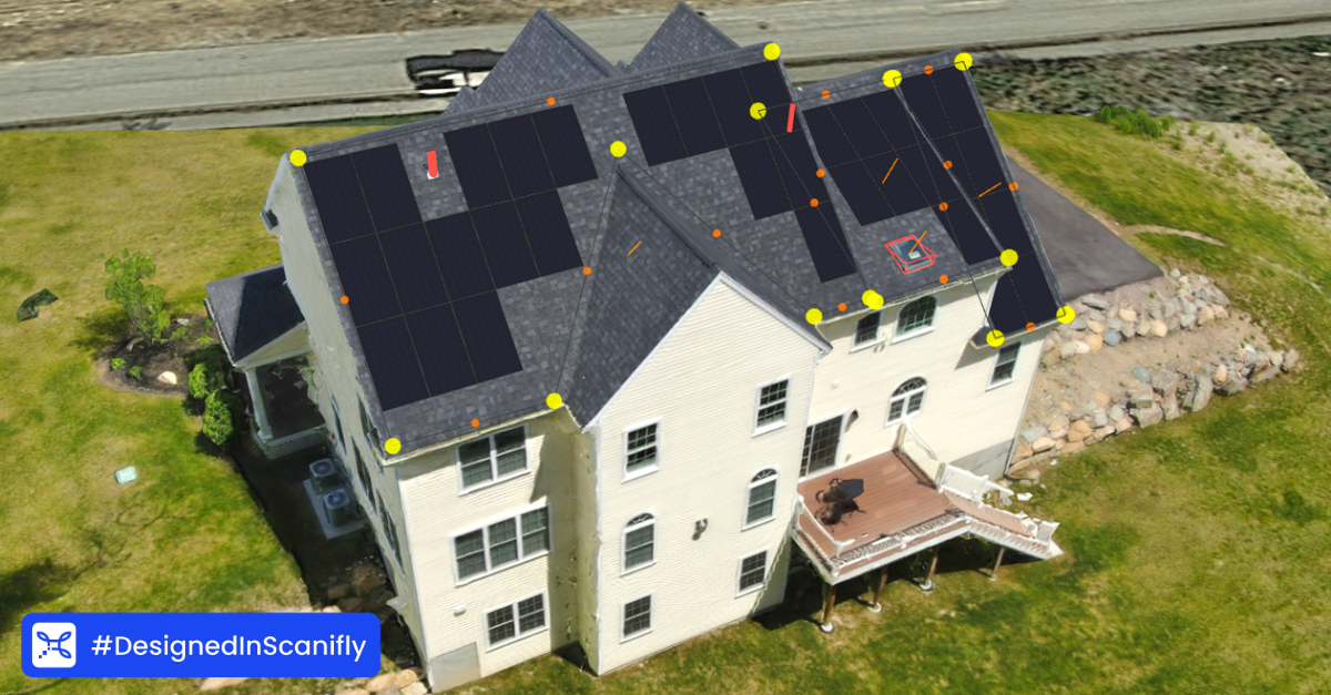
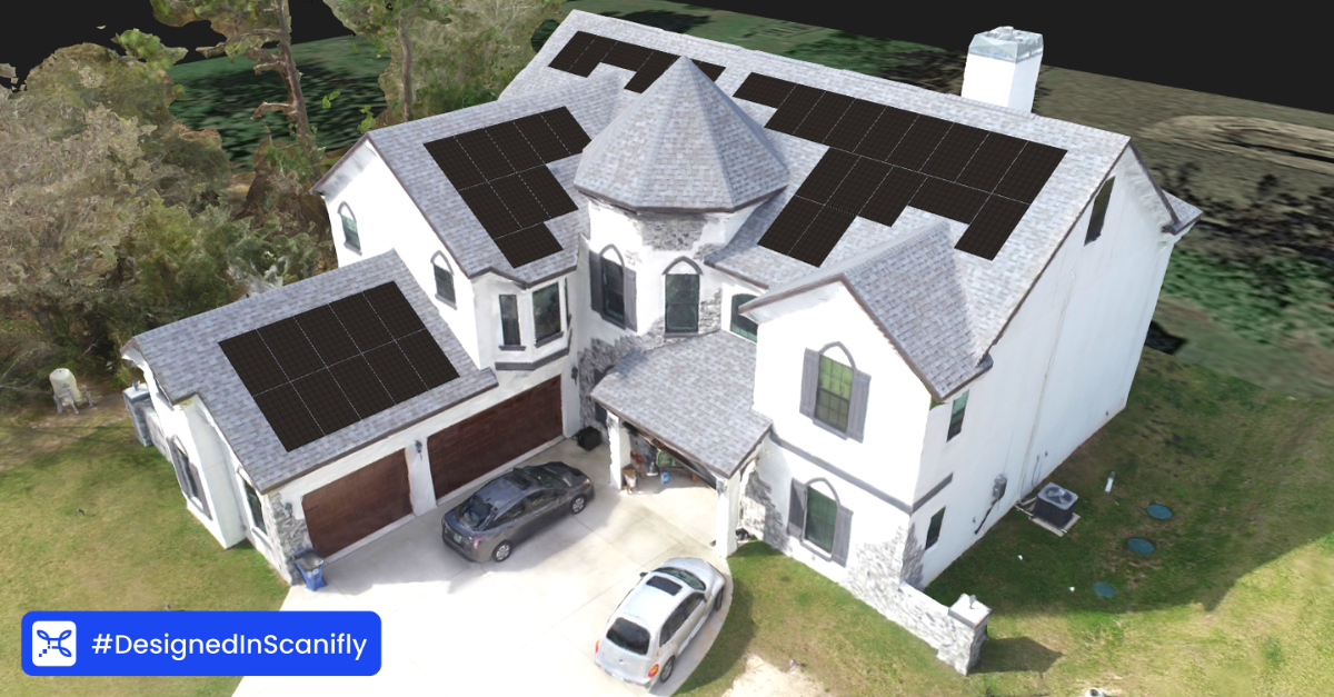
When designing in 2D, you need to manually mark the roof lines with angles in degrees, pitches, and other measurements. It’s somewhat accurate, but not intuitive. Additionally, the real estate under the soffit in a 2D plan view leaves a designer guessing when it’s time to add setbacks.
With 3D, you can see the specific pitches, roof details, edges, and hard-to-see real estate under the soffit. Further, 3D shows the different elevation changes across a property, which is helpful for designing around obstructions and roof height changes.
2. More accurate shading analysis
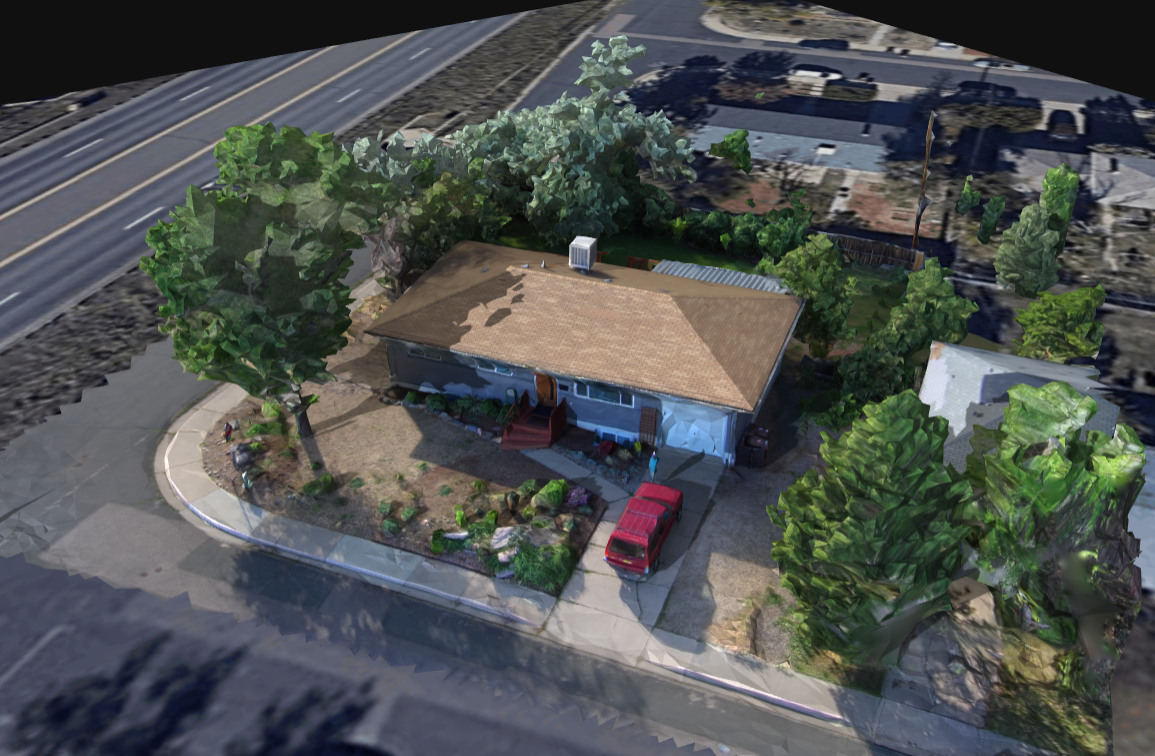
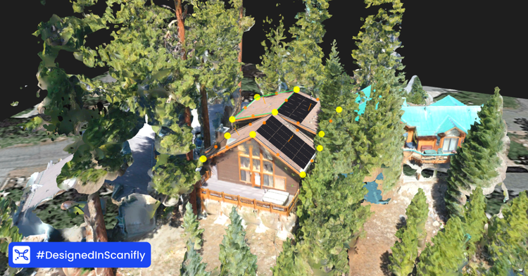
Shading has a large impact on every solar project as too much shade can limit how much energy a solar system generates. As a result, projects completed without an accurate shading analysis mean customers could end up with a system that can’t deliver on its promises.
The key benefit of 3D drone-based data is that you get real-world context to automatically conduct accurate shading analyses. For example, you get real-life shapes and sizes of trees with drone data, whereas outdated satellite imagery might show a sapling or much smaller tree that will impact the shading analysis. Because drone data allows you to generate a 3D representation of the site for accurate modeling, solar contractors can better manage homeowner expectations around projected energy production. This is particularly useful for contractors who have production guarantees.
3. Higher quality site perspective
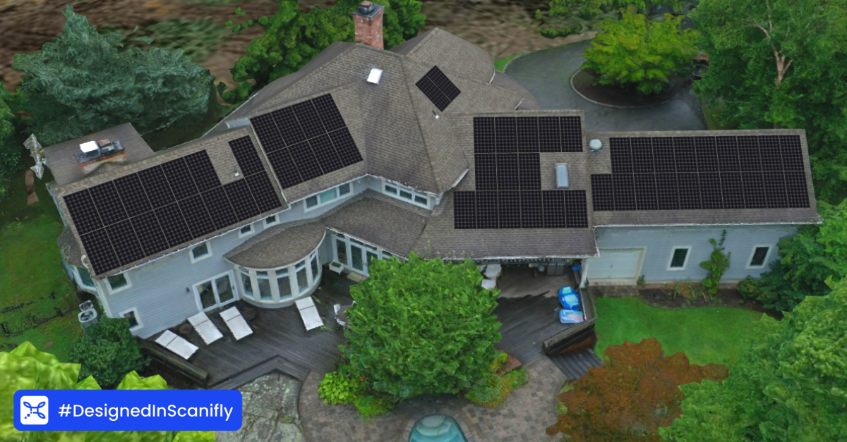
There’s more to a solar PV system than just the panels. You need to run conduit to interconnected components, handle any internal attic obstructions, deal with specific customer requests, and more.
At best, 2D renderings show you where things are on a map. At worst, they miss out on critical visual details that you’d spot in an instant on site. That’s where 3D thrives; it gives a perspective like you’re actually at the site. This is especially helpful in solar when home ownership associates (HOAs) and local municipalities have strict requirements when it comes to preserving the architectural and historical integrity of the structure.
Full 3D models are also impactful for installers. Since many don’t go to a site prior to installation day, they work off whatever plans surveyors and designers hand them. If the designs seem accurate enough on 2D but a problem arises on install day, it could lead to a call-off or emergency redesign. A 3D model allows for more perspective of the whole property, so installers aren’t waiting for installation day to get site context.
4. Increased customizability
Sometimes you have to get creative to solve a shade problem or you have a demanding customer. In both cases, you’ll need to do some customizations.
Using a 2D rendering, customization is taxing, if not impossible. There are a lot of writing side notes and legends with arrows pointing to the relevant location. In the end, the page could look more like scratch paper than an official document or the customizations list could become a lengthy appendix that renders the initial plan almost moot.
In a 3D model, you can visualize the changes and more intuitively understand how the change will impact the site itself. This leads to a much better understanding of possible issues down the line because you are able to look at the whole property from every axis, instead of solely a top-down view.
3D and 2D can work in harmony
Modeling in 3D is a great way to get a true perspective of the property. But it’s also worth noting that 2D plans have their place. For example, many solar contractors export to a DWG AutoCAD LT file, or more generically a DXF. It’s important to note, that 3D drawings exported from drone data are also in DWG and DXF format, so working in both 2D and 3D is harmonious.
Having construction documents be in 2D is fine, but keep that Z-axis dimension skew in mind when measuring from ridge to eave. This is where 3D comes in handy, it allows you to measure in any projection/view you like, which results in a well-planned installation that won’t have redesigns or call-offs, leading to happy customers.