Solmetric SunEye
A shading analysis is delicate work in solar because it directly impacts how much energy a solar system can produce. Some shade is expected, but too much can crush a system’s potential and anger paying customers. With that in mind, an entire ecosystem of solar shading tools emerged to help contractors build accurate energy production estimates.
The history of shading analysis tools aligns with the history of technology itself, moving from Pathfinders to SunEyes to more modern software-driven solutions. The Scanifly team has seen this evolution firsthand over the years and identified three distinct phases of tools, with each iteration becoming more precise, more scalable, and less expensive.
Phase 1: Handheld hardware
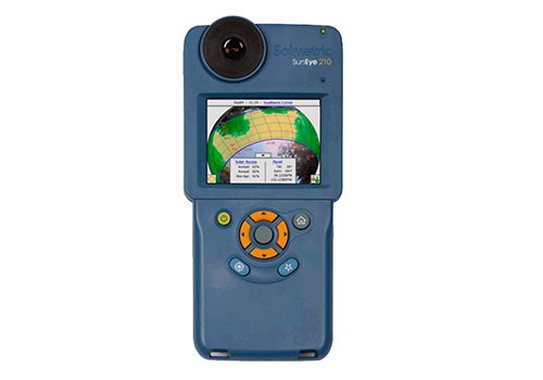
At the onset of residential solar energy in the early 2000’s, shading tools came in hardware form. Market leaders like Pathfinder and Solmetric (now owned by Sunrun) used sophisticated hardware to assess shading implications for solar installations. These tools still exist today and have evolved somewhat since their original form, becoming more intuitive and user-friendly.
While a massive improvement over trying to manually measure shadows and use sun movement analytical math to identify shading, these tools remained clunky, expensive, and handheld, and required post-processing in the office after the data was captured on site. Even today, surveyors need to go on the roof to use them, meaning they can be a potential safety hazard as many surveyors admit to dropping equipment off the roof. Further, finding replacement parts can be challenging and expensive.
Handheld hardware still exists today but unfortunately, the software running these handheld devices is out of date, replacement parts are expensive and hard to find, and there are always risks of hardware falling off the roof.
“Despite having to go on the roof, Solmetric’s SunEye is a great product that produces actionable and accurate onsite shading,” according to Matt Alestra, Vice President of Field Services for NovoSource’s SunSystem Technologies division. “Unfortunately though, Solmetric’s service is lackluster. It is tough to get parts or fixes, and the software updates are intermittent and ineffective. We’re just stuck buying new SunEyes, which cost more than drones.”
Phase 2: Satellites and early software
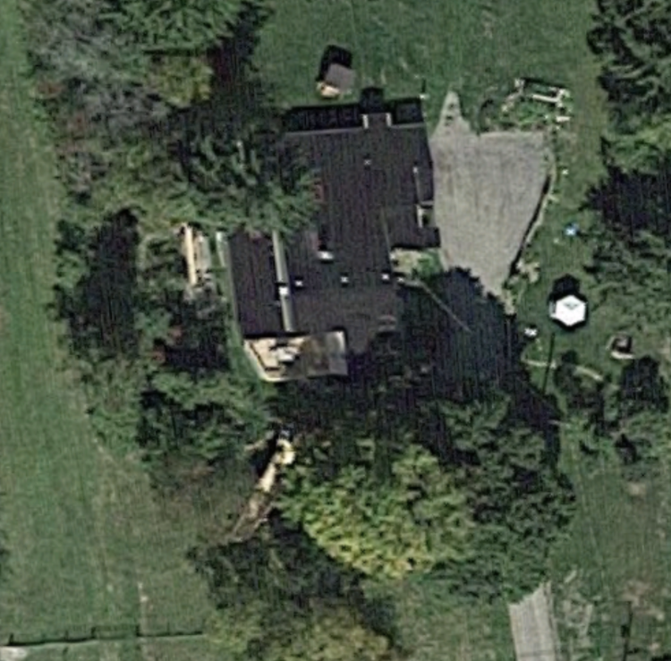
Improvements in satellite imagery made it possible to use them for a shading analysis, particularly with Google’s Project Sunroof democratizing how to figure out what projects are viable for solar. Other generic design softwares such as SketchUp also added shadow-rendering tools, making shading analysis a little easier in the early design steps of a solar installation.
This was a different approach versus hardware-based solutions. It was more flexible and easier to use because users stayed off the roof. Many regulators and lenders therefore approved the solution. However, over time, it has become clear that these tools aren’t necessarily more or even equally as accurate.
Roughly 30% of satellite imagery based shading studies are off by >10% from the reality of the site. Nearly all (92%) of surveyors say they have to manually verify satellite images, with almost none saying satellite imagery is perfectly accurate. While it doesn’t need to be perfectly accurate for shading analysis conducted during the preliminary design and sales proposals stages, mistakes could seriously overestimate energy production, leading to angry customers and ruined production guarantees.
Phase 3: Drones and modernization in solar shading tools
The most recent technology update is improved software fed by high-quality drone images.
SunCommon
Some platforms accept a “Horizon report,” which has been used as more of an inspection tool than a quantifiable shade analysis tool. Horizon report data is acquired when a drone hovers over one central point on the property and captures images while looking out at the surrounding horizon rotating in all cardinal directions and rotating 360 degrees. This gives asset owners and lenders a site assessor’s perspective, looking around the property for obstructions. So far, this tool has varied because it’s difficult to quantify shading implications for solar projects. A lot of this analysis includes eyeballing tree heights and comparing that to satellite imagery-based estimates. You can see the shadows, but it’s not easy to translate that knowledge into energy production estimates.
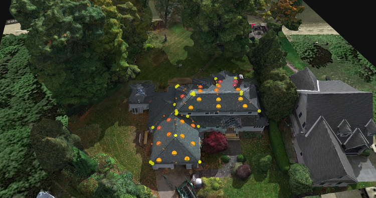
Scanifly introduced a patented drone-based shade analysis solution, which provides the same onsite accuracy of the hand held Solmetric SunEye, with the ease of a software solution and staying off the roof. The software uses a 3D mapped environment to analyze shade, which was created using a drone flying in point of interest (POI) flight pattern collecting oblique imagery. Scanifly’s software measures the impact of shade on solar production using a similar hemispherical method as the Pathfinder and the Solmetric SunEye.
“While the Pathfinder shade tool is a great low-cost solution, it can be quite cumbersome and time consuming to generate an accurate shading report. The Scanifly shading analysis tool has greatly reduced the amount of time we spend on site shading analysis as well as providing highly accurate reports we can rely on when guaranteeing production to our customers,” shared Casey Wilson, a senior engineer at Altenergy. “We’ll never go back to manual shading analysis again!”
Further, Scanifly remains the only drone-based solar software to be reviewed and validated by the major regulators and lenders across the US, including NYSERDA, MassCEC, the CEC, Rhode Island, Oncor, and Austin Energy. Currently, Scanifly’s shade analysis has been used to accurately design thousands of projects all over the world.
Drone-based shading tools cannot solve everything for All Energy Solar though, headquartered in Minnesota and with offices in Wisconsin and Massachusetts. “While the vast majority of our projects are now most efficiently and accurately assessed using drones and the Scanifly software, we still find the SunEye useful in certain situations. We use the SunEye for our ground mount projects as the convenience of the drone is negated when on the ground and vegetation can make accurate elevation data difficult to gather from drone imagery. There are also some no-fly zones in areas where we do business, and getting permission to fly a drone in those areas is not always possible or timely. In those cases, we use the SunEye to gather solar access data,” according to Alfie Alschuler, All Energy’s Director of Engineering and Site Visits. “Finally, we have also found that during a light rain, we cannot fly a drone but we can safely use the SunEye on the roof. This allows us to avoid returning to the site for a second visit to get solar access data.”
“Our experience is that drones and Scanifly are the preferred choice for over 90% of our projects as it saves us time, keeps our techs safe and provides high quality imagery and data for our designers and customers,” Alschuler adds. “However, the SunEye remains an important back-up tool in situations where flying the drone is not a practical option.”
The march of progress for shading tools continues
Along with the overall technology ecosystem, shading tools will continue to become more sophisticated. However, a tool is only as useful as its underlying data. With that in mind, the value of a solar shading analysis is not just the software you use but how you capture data, with onsite high-quality images being the best available option.