Customer Story
Northwest Electric & Solar Doubles Site Survey Capacity and Cuts Redesigns by 33% with Drone-Based Design in the Pacific Northwest
Results From Using Scanifly
TL;DR
- Northwest Electric and Solar (NWES) first adopted Scanifly in 2020 to replace manual roof climbs with drone-based site surveys, doubling their site assessment capacity and improving safety.
- A few years later, they restructured their sales process and switched to remote-only design to cut costs and truck rolls, but quickly ran into the limitations of designing solar in the Pacific Northwest without onsite data.
- They returned to Scanifly from Aurora for more accurate tree modeling and measurements, real-time onsite shading analysis, and a faster design workflow, and saw immediate results across the entire project lifecycle.
Meet Northwest Electric & Solar (NWES)
Northwest Electric and Solar (NWES) is a Kenmore, Washington-based electrical and energy installation company serving homeowners across all of Washington state. Their mission is helping people take control of their energy journey by generating, storing, and using electricity on their own terms. From solar and battery storage to full home electrification, NWES approaches every project as a long-term partnership.
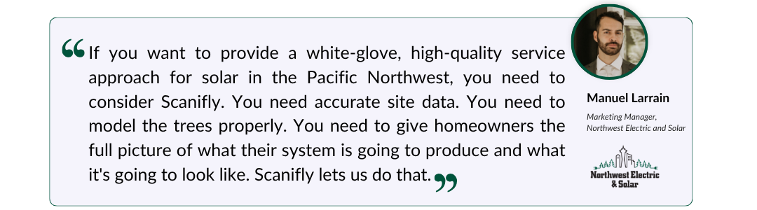
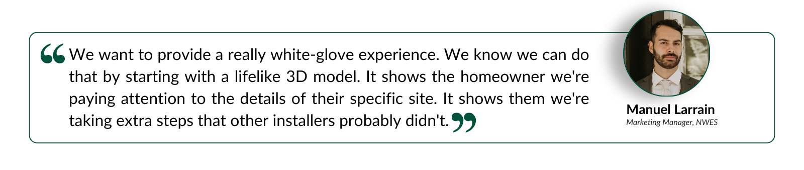
“We’re helping folks achieve energy independence and resilience,” said Manuel Larrain, Marketing Manager at NWES. “And we really want to approach things with a custom, white-glove experience from the very first conversation.”
The Challenge: A Market That Punishes Imprecise Data
Designing rooftop solar in the Pacific Northwest comes with challenges that installers in sunnier, more straightforward markets rarely face.
Washington homeowners typically enter one-to-one net metering agreements with their utility. The credits they accumulate during peak production months—April through September—need to carry them through a winter that’s cloudy, rainy, and short on solar hours. Get the summer production numbers wrong, and the homeowner’s ROI never materializes as promised.
One of the most common solar design errors in this market is poor shading analysis. Washington has dense, mature tree canopies, including tall Douglas firs and other conifers that cast long, complex shadows depending on time of day and season. Remote design tools still model trees as generic rounded shapes, or ‘lollipop’ trees, that look nothing like the actual vegetation on site. And in more rural parts of Washington, satellite imagery and LiDAR coverage is almost always outdated or incomplete, making remote designs a starting point at best.
Before NWES adopted Scanifly, their site assessors were going to nearly every house before a contract was signed, hauling ladders and a SunEye device onto rooftops to gather measurements and shade readings by hand. Limited to two or three surveys per day, it was physically demanding work that still left the team cross-referencing handwritten notes with a remote design.
“We’d have to let the homeowner know it might be a day or two before we get back to them with an updated proposal,” said Manuel. “It was a drawn-out process, and we still weren’t fully confident we had the right data.”
Finding Scanifly: Faster, Safer Site Surveys
NWES came to Scanifly in 2020 looking for a way to make site assessments faster, safer, and more accurate. By replacing the ladder and tape measure with a quick drone flight, they saw an immediate impact.
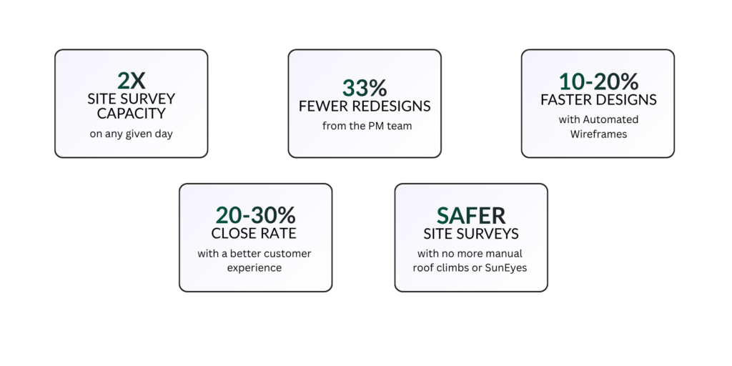
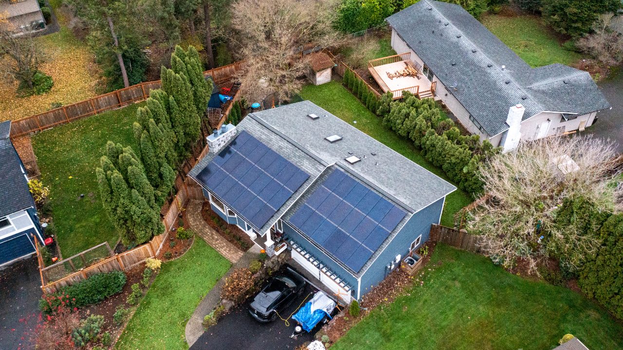
Survey capacity doubled, going from two or three visits per day to five, six, or more. The drone replaced manual roof climbs entirely, eliminating the safety risks that came with using the ladder, tape measure, and SunEye. Better yet, the photorealistic 3D models gave the sales team a visual they had never been able to offer before: a true representation of what solar would look like on the customer’s home.
“Homeowners have a lot of thoughts about what solar looks like on a home,” Manuel said. “You can’t rent or borrow the product before you buy it. Being able to give them a color, one-to-one 3D model of their actual house with the panels placed exactly where they’d go was a huge boost for our sales process.”
It Wasn't Goodbye, It Was See You Later
A few years in, NWES reorganized their sales process, shifting site surveys to post-contract. With fewer pre-sale drone flights needed and pressure to simplify their tech stack and cut costs, removing the Scanifly step from the workflow felt like a reasonable decision.
But designing with remote data alone came with tradeoffs that weren’t immediately visible: still more time spent on-site, even with fewer overall surveys, less confidence in designs, and customer experience gaps that only became apparent later in the project lifecycle.
“It seemed like a reasonable way to reduce costs,” Manuel said. “But we started running into more and more situations where the remote data just wasn’t good enough, and we were feeling that further down the line in the process.”
The Comeback: What Remote Designs Couldn't Do
The problems accumulated job by job, and the pattern became hard to ignore. NWES returned to Scanifly with a clearer picture of exactly what remote-only design was costing them, and how to fix it.
Accurate Tree Modeling and Real-Time Shading Analysis
Remote imagery and LiDAR in Washington State are often outdated or incomplete, and the trees most remote tools use are a poor representation of the real trees on the property. With Scanifly, the drone-based 3D model and Viewshed shading analysis ensure production estimates are based on current, accurate data.
Viewshed calculates real-time shading for any panel location in seconds without anyone setting foot on the roof. The team can also run a sun path simulation, showing homeowners exactly how shade moves across their roof at any hour of any day, and how each tree impacts production.
“We can show them how shading from trees impacts their array and give them suggestions on which trees to consider trimming or removing,” Manuel said. “We can give them those recommendations with a lot more confidence than if we were working from remote data. That’s huge when you’re helping someone make a 25-year investment.”
Faster Designs with Automated Wireframes
Scanifly has added dozens of new features and capabilities since NWES’s first run, making the design process faster and smoother than ever, without sacrificing accuracy. Using Automated Wireframes, Scanifly automatically outlines every roof segment, obstruction, and fire setback on the 3D model, so designers go straight to panel placement and layout customization instead of tracing rooflines manually. That alone cut design time by up to 20%.
A White-Glove Experience Remote Design Can’t Replicate
Returning to Scanifly also restored NWES’s ability to provide the kind of customer experience that remote design simply can’t match. When a sales consultant flies the drone, creates a photorealistic 3D replica of the home and surrounding trees, and walks through exactly how shading will affect their system, the homeowner isn’t being asked to trust a grainy satellite image. They’re literally visualizing what it will look like to go solar.
“It already creates a strong connection before they’ve even signed,” Manuel said. “And then when they see us fly the drone and walk them through what we found, it builds trust that we’re going to be there for the long run.”
Project Showcase
Designing Solar in the PNW: Where Remote Data Falls Short
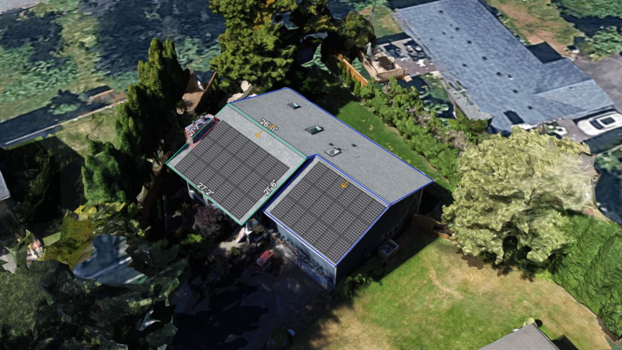
Washington’s rural homes, mature tree canopies, and complex roof conditions create a market where remote data consistently falls short. Here’s where Scanifly’s drone-based workflow makes the difference:
- Photorealistic 3D models built from real data. Every Scanifly model is generated from 150 to 300+ drone images processed through Scanifly’s photogrammetry engine, producing a to-scale replica of the property, including the roof measurements, obstructions, and surrounding vegetation. In the Pacific Northwest, that means trees that actually look like trees, with realistic canopy shapes, accurate heights, and precise locations relative to the array.
- Real-time onsite shading analysis. Scanifly’s Viewshed technology calculates shading for any panel or location on the 3D model in seconds, with no roof climbs required. Designers get accurate TSRF and solar access values, and homeowners get a visual sun path simulation showing exactly how shade moves across their property throughout the year. Contractors and homeowners can be confident the system will perform as promised.
The Impact: Accuracy That Pays Off Downstream
Faster Surveys, More Capacity
With Scanifly and the drone back in the workflow, site assessment capacity doubled once again. No more manual roof climbs, no more hauling equipment, and no more capping the day at two or three visits.
Faster Designs, Fewer Revisions
Automated Wireframes cut design time by 10 to 20%, and because those designs are built from onsite measurements, redesign requests from the PM team dropped from 25 to 30 per 100 projects down to fewer than 15, a reduction of roughly 33%.
“With our revision reductions from having site-accurate designs, it’s about a 33% reduction in redesigns from the PM team,” Manuel said. “Adding Scanifly on top of our onboarding processes really helps create a smooth transition to the PM team and all the way through to the install.”
Confidence All the Way to Install Day
When the install team arrives on site, they’re working from a design they know will fit. No remeasuring, no scrambling to reconcile what the drawing shows with the reality onsite. And the sales team has responded just as positively.
“They’re just happy to have another tool to provide a better experience and to be confident in what they’re selling,” Manuel said. “That confidence matters. When you’re asking someone to make a 25-year investment, the last thing you want is to be unsure about the design you’re presenting.”
In Their Words