Denver, CO, Nov. 28, 2023 — Scanifly announced integrations with various remote data sources as part of its new preliminary design solution, Scanifly Prelim.
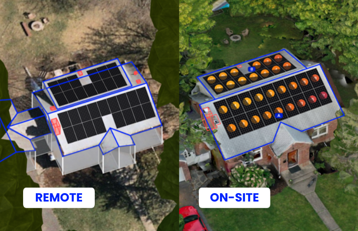
Scanifly Prelim offers Contractors a budget-conscious remote design solution, with all the features of Scanifly3D, including the ability to create a PV layout, production estimate, and shading analysis within minutes. The Prelim product is particularly beneficial for Contractors who have their own internal proposal and financing tools or are seeking to consolidate their design solutions, and broader software stack, onto one platform.
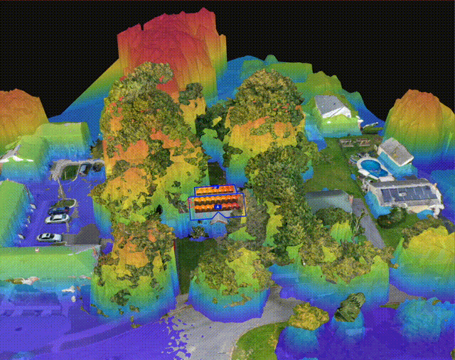
To further enhance the quality of preliminary designs, Scanifly added Nearmap’s leading aerial data coverage, as well as imagery from well-known satellite imagery providers Google Maps, Bing, and Mapbox. Scanifly also incorporated the United States Geological Survey’s (USGS) publicly available LiDAR data. The “light detecting and ranging” data is commonly used as a reference for modeling a site and remotely estimating a project’s shading.
The LiDAR data can also be viewed with Scanifly’s drone-based models, which are already equally accurate to other on-site tools, like the Solmetric SunEye. This considerably improves the ability to estimate shading during the fall and winter months, when dormant deciduous trees may not display their full shading impact due to the lack of foliage present during data capture. This reinforces Scanifly’s patented Viewshed shading technology and hyper-local shading simulations that are already approved by numerous regulators and lenders as bankable.
“The addition of Nearmap, satellite imagery providers, and LiDAR data positions Scanifly to be a comprehensive platform for many stages of a residential and commercial solar project’s life,” said CEO Jason Steinberg. “All of Scanifly’s customer-facing people previously worked for solar contractors or construction companies, including as solar surveyors, designers, and installers. We are eager to support our fellow solar professionals and build technology that improves the quality of workmanship, safety and speed for Contractors of all sizes.”
Along with Scanifly Mobile’s site survey and field operations tools released in early 2023, Scanifly now unifies a variety of data sources to facilitate a seamless initial and final design experience. With an end-to-end design solution that now includes aerial imagery across all accuracy levels, contractors get speed, accessibility, and precision on a single platform – with no revisions or changes on install day.
For more information on Scanifly Prelim or its core Scanifly3D products, please schedule a call with our team here.
Contact:
Maddie Robinson
(863) 591-6138