LiDAR
What Is LiDAR And Why Should You Care?
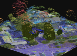
Key takeaway: LiDAR is a government-funded data source that shows geospatial 3D information, such as structure mapping, vegetation, and terrain, making it helpful for collecting

What Is LiDAR And Why Should You Care?
Key takeaway: LiDAR is a government-funded data source that shows geospatial 3D information, such as structure mapping, vegetation, and terrain, making it helpful for collecting