Can TPO save solar from itself? Read our four incentives TPO should offer in 2026 to entice sales reps & EPCs to put homeowners’ interests first.

BLOG

The Best Solar Sales, Design, & Ops Resources

Drones
All Posts

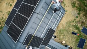
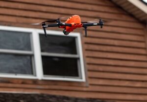
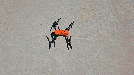
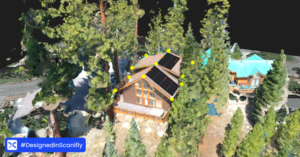
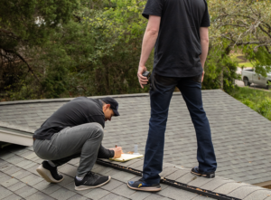
How Often Do You (Actually) Need “Boots on the Roof”?

Solar requires going on the roof — but you shouldn’t put Surveyors at risk for any longer than necessary. Instead of assuming you always need “boots on the roof”, consider leveraging technology where appropriate to keep Surveyors safe, while making the job both faster and more accurate.

Read More »
All Posts

“It’s Accurate Enough”: Three Words Every Installer Hates

Most install-day problems originate from insufficient survey data. But this isn’t about blame. Surveyors deserve the right tools—software, drones and mobile tools—that allow them to safely collect comprehensive, accurate measurements. When you start with high-quality data upfront, you don’t need to worry about issues that waste time, cause delays, or end in install day call-offs.

Read More »
Drones

The Best Drones for Different Solar Use Cases

For Marketers, the DJI Mavic Mini is a top choice. For Surveyors, look at the DJI Air 2S or Autel EVO II V3. For O&M use cases on residential and small commercial systems, consider the DJI Mavic 3 Enterprise or Autel EVO II Dual. All of these models were chosen for their balance of features and price points. That said, there is a strong case for high-end drones like Parrot Anafi and Skydio as well.

Read More »
How to Get A Drone Repaired | Scanifly
All Posts

How To Get A Drone Repaired 

The commercial use of drones has exploded across the United States—there are now over 340,000 registered commercial drone pilots. Solar, in particular, has embraced drones

Read More »
commercial solar

What Data Is My Drone Capturing?

Drones can capture all the data necessary for a highly-accurate solar survey and design. Beyond that, drones also collect data that’s essential for niche commercial use cases and provide data on the drone itself, making repairs or upgrades easier.

Learn why drone imagery is more accurate and real-time than static satellite and aerial imagery, or LiDAR point cloud data.

Read More »

Subscribe to our newsletter!

Join the 1,000’s of solar pros who get curated articles, podcasts, and product updates directly to their inbox to help sharpen their skills and grow their career in solar.