All Posts
Cheaper and Faster Isn’t a Strategy—It’s a Risk
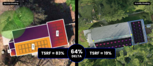
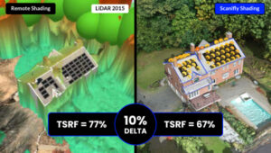
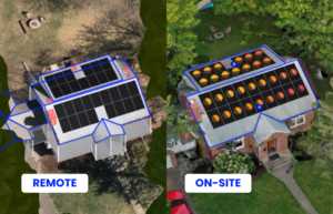
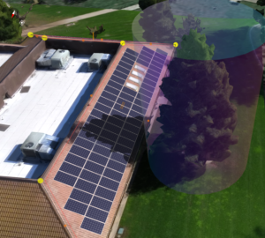
Fast AI solar proposals often have 50%+ revision rates due to poor shading analysis. Learn why 70% of design errors stem from inaccurate site data and how quality solar companies balance speed with accuracy to prevent costly change orders.