Rather than managing multiple subscriptions and technologies, you should work with a single platform that combines design tools and drone capabilities. In this case, you get the best of both worlds: improved work processes and cost savings in your software stack.
Here are five reasons to pursue a centralized tech platform:
1. Perfect accuracy you can count on
Separating your drone program from your design software yields reduced accuracy:
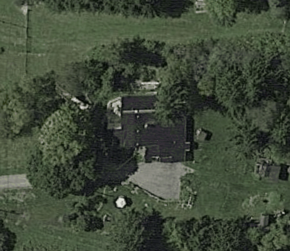
- Satellite and aerial imagery cannot spot every roof obstruction.
- Satellite measurements are often inaccurate and grainy.
- Top-down nadir photos offer updated map images, but leave room for errors because designers have to manually estimate the z-axis on a property and the images often are skewed.
Furthermore, some drone platforms lock you into specific drone models and force you into a one-click automated flight using a lawnmower pattern. This removes any site-specific customization that is needed, given the property’s features and solar-specific implications.
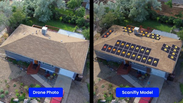
Combining point-of-interest flight data from any georeferencing drone and design tools in a single platform is the only way to deliver a perfectly accurate 3D, photorealistic model that you can count on for a 100% fit rate — just ask Dynamic SLR.
2. Faster, higher quality design and shade analysis
Unifying tech platforms speeds up every step of the design process without compromising accuracy:
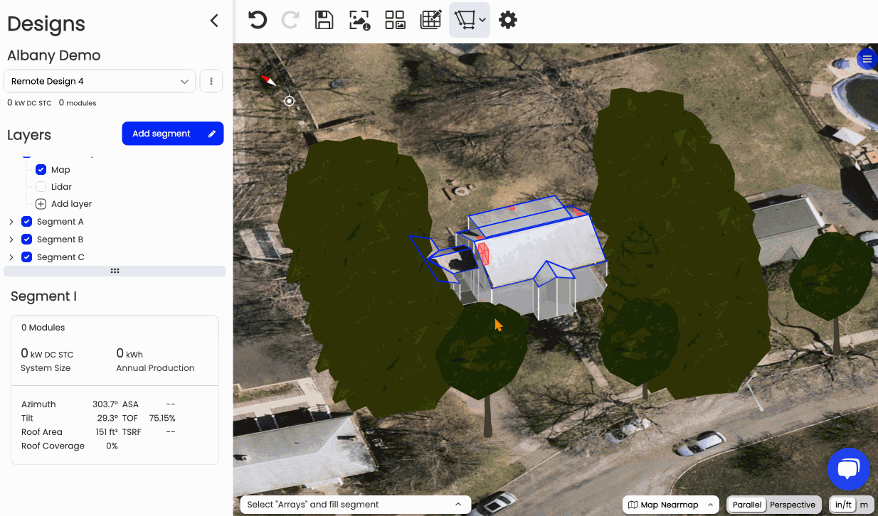
- Easily create preliminary designs: You can layer on different data sources like LiDAR, Nearmap, and Google3D to quickly get an estimate.
- Speed up final designs: Digitally uploading on-site data, such as electrical, structural, and property data, helps avoid human error from pen-and-paper and other manual onsite data collection practices.
- Deliver comprehensive shade analysis: Leveraging drone data from an oblique, point-of-interest flight path captures every potential shade source, producing the most precise, on-site shade analysis available.
- Gain more opportunities to scale: Utilize additional design resources to get full plan sets within 48 hours.
Better designs result in better projects. For instance, Solar Energy Services used to spend up to three weeks to go from survey to proposal — now it only takes three days. And on top of that, the increased accuracy means no more revisions.
3. Increased team capacity
Drones make Surveyors up to 5x more efficient — a drone-based residential survey only takes about 10 minutes and a commercial is between 20-25 minutes — and Surveyors can save hours per day with field data uploads.
Further, using a drone means less wear and tear on the body, making it easier to retain great talent and hire more experienced Surveyors on your team.
With accurate drone data, you also reduce (or eliminate) last-minute revisions and install day call-offs, an investment that saves your team hours of extra time and delivers a better customer experience.
4. Frictionless finance
Financing providers often pay in milestones — and every milestone hinges on accurate data. For instance, the first tranche is often based on survey data and shading analysis, the second leverages installation data to indicate a notice to proceed, and final payout based on post-commissioning information.
With drone-based surveys and field operations tools integrated into your design software, you’ll have the necessary data, like trustworthy plansets and comprehensive installation checklists. Leveraging drone data for shading analysis also means perfectly accurate vegetation modeling and obstruction detection, ensuring anything that could impact solar production is considered.
This accuracy and comprehensiveness reduce friction with finance providers, making it easy to get shorter SLAs for payment with fewer rejections or ambiguity.
5. Save money with a more efficient process
When you combine your drone program with a design platform, you’re one step closer to consolidating your tech stack. If you use Scanifly, for example, you don’t have to find and individually pay for a design platform, a mobile data collection app, drone software, API calls between platforms, and a development team to manage it all. It’s all in one place.
This frees up time and mental energy to focus on what really matters: building quick, high-quality designs that both improve close rates and eliminate revisions.
You deserve a one-stop shop, not betting on one-click
Parsing out every step in the solar process causes more headaches. And this issue only gets worse if a platform forces you to use a specific drone. If a platform requires a specific drone, you’re forced to pay whatever they charge — often a significant markup.
Instead, use a platform that empowers drone optionality so you can buy the drone that’s right for you.
When you work with software that combines drone data and a design platform, you get perfect accuracy, faster design times, more team capacity, and frictionless finance with loan and lease providers. That means a better customer experience, faster turnover, and fewer headaches — all meaning you can focus on building your business rather than dealing with problems.